Coordinate Systems
MapProvision supports over 2,400 coordinate systems. These are taken from the European Petroleum
Survey Group (EPSG) specifications.
If the spatial data is in a coordinate system different to the default of WGS84 then provided
you specify which coordinate system your data is in MapProvision will project it for you.
If you require a coordinate system projection for your data that is not on the default drop
down list then select Show All from the Coordinate System drop down box.
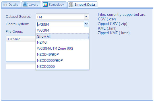
This will popup a selection dialog with all the coordinate systems available.
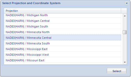
A list of all supported coordinate systems is available here.
Select the one you want and this will now be selected in the Coordinate System drop down box and
will be used to project your spatial data collection to the WGS84 coordinate system which is used
by MapProvision and Google Maps.
When you are using data from another coordinate system then the column headers "Northing" and "Easting"
are also allowed to specify the latitude and longitude values.
|