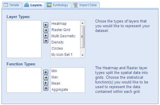
Layer Selection
The layer selection tool is where you must specify which layer types you want to use with your
dataset.
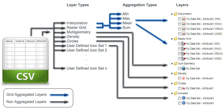
A dataset can have multiple different attributes associated with each spatial feature.
Each attribute can have multiple different layers types to represent them.
In the case of the Raster Grid and Interpolation layers as these are aggregated into grids they
can also have one or more aggregation functions to describe them consisting of even more layers
representing the attribute.
All selected layer types will be assigned to all attributes which are selected as layer attributes in the
Import Data form. If you do not want all attributes associated
with all the selected layer types you can remove any unwanted ones using the
Organize Folders tool.
The following diagram illustrates how the Layer Types you select are mapped to actual spatial layers that
will be available in your Data Collection's Viewer Portal.
Attribute Layer Type Mappings.
|
|
KML Imports
If you are importing from a KML file, attributes are taken from the
KML Extended Data tag as shown in the following example.
<Placemark>
<name maxLines="1">1558</name>
<description></description>
<ExtendedData>
<Data name="attribute1">
<value>123</value>
</Data>
<Data name="attribute2">
<value>234</value>
</Data>
</ExtendedData>
<MultiGeometry>
<Point>
<coordinates> 175.016974,-36.945977</coordinates>
</Point>
</MultiGeometry>
</Placemark>
|