Fit to Bounds
When datasets are created in MapProvision their maximum and minimum bounds are stored
in the dataset's metadata. These are also updated when data is added to the dataset.
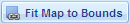
You can automatically set the Viewer map bounds to the bounds of the selected dataset by clicking the
Fit to Bounds button which will auto position the map to the layer's bounding box.
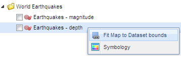
Or alternatively you can select the layer and right click to open the tree menu and
select 'Fit Map to dataset Bounds'.
|